
Snowmelt
In a cold climate, winter precipitation does not run off when it falls. It sits on the ground for weeks and arrives all at once during a thaw, often coinciding with rain. For many alpine and northern networks that is the critical event, and a model without snowmelt cannot see it at all.
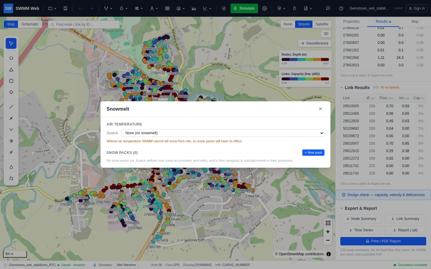
Two halves, and both are needed
Section titled “Two halves, and both are needed”Snowmelt has two parts, and each on its own does nothing:
- Air temperature tells SWMM what falls as snow rather than rain.
- A snow pack describes how snow accumulates and melts on a surface, and is assigned to subcatchments.
Temperature with no pack means nothing accumulates. A pack with no temperature means nothing ever freezes. Neither is an engine error, so the run succeeds and quietly produces no snow.
Setting it up
Section titled “Setting it up”Open Model data ▸ Snowmelt (temperature & snow packs).
-
Air temperature. Choose a time series and pick the series holding your temperature record, or point at a climate file. A time series is the usual choice, and it can be imported from CSV like any other.
-
Snowmelt climatology. Six values:
Parameter What it does Snow / rain divide Precipitation below this temperature falls as snow Antecedent temperature weight How strongly recent temperatures carry forward Negative melt ratio Melt rate below freezing relative to above Average elevation Drives the seasonal melt calculation Latitude Same, through day length Longitude correction Adjusts solar timing within a time zone -
Create a snow pack. Press + New pack. It is created with all three surfaces already present, because SWMM rejects a partial pack outright.
-
Set the melt parameters per surface.
CminandCmaxare the melt coefficients at the winter and summer solstices;Tbaseis the temperature above which melting starts;FWFis how much liquid water the pack holds before it drains. -
Assign the pack to subcatchments. Select a subcatchment, open Properties, and choose it under Snow Pack. Until you do this, the pack has no effect at all.
The three surfaces
Section titled “The three surfaces”A pack describes three surfaces, because snow behaves differently on each:
- Impervious - roads and roofs. Melts fastest.
- Pervious - grass and soil, where some meltwater infiltrates.
- Plowable - the fraction of the impervious area that gets cleared. Its last parameter is that fraction, not a depth, which is the one column that means something different from the row above it.
Optional removal rules describe where plowed snow goes: out of the catchment, to the pervious area, to immediate melt, or to another subcatchment.
What it changes
Section titled “What it changes”A worked comparison, same network and the same 20 mm of winter precipitation:
| without a snow pack | with a snow pack | |
|---|---|---|
| Surface runoff | 14.25 | 0.87 |
| Final snow cover | (not reported) | 18.12 |
Eighteen of twenty millimetres is held as snow instead of running off. The network sees almost nothing during the storm, then everything later when it thaws.
Where the parameters come from
Section titled “Where the parameters come from”Melt coefficients and base temperatures are regional. National guidance, published studies for a comparable climate, or calibration against observed winter flows are all better than the defaults, which are deliberately conservative starting points rather than recommendations.
If you have winter flow monitoring, calibrate against a thaw: the timing of the
melt peak is far more sensitive to Cmax and Tbase than the volume is.